Re: maps with different projection ?
Posted: Fri Oct 29, 2021 6:15 pm
There are no polar issues in Freeciv maps which don't depict an entire planet. A map of only the British isles, for instance, without WrapY has no problems regarding which way is north or south. Top is always north, bottom is always south (within the Freeciv game.)
The "GreenMarble" color image has the north pole sea ice constructed from MODIS data -- it's accurate. You can copy the white shaded pixels to a new PNG for use as an Arctic ice overlay in your image (scaled up to size.) The base GreenMarble image is created by NASA. The north pole was added by the guy who controls the web site at the link.
Arctic overlay layer at 21600 pixel width --> https://www.sendspace.com/file/xkwy81
For the GEBCO bathy/elev 8 bit image, you could treat the one byte values as a range (0-255 meters), then using pixel x,y from your tst.png image file, determine if the pixel at x,y is water or land in your image. If land, convert 1 byte value from the depth/elevation image pixel at same x,y to elevation. If the pixel in your image is water, convert the 1 byte value to depth. There are only 2 ocean depths in Freeciv, so perhaps convert to only 2 values such as anything less than 100 meters depth is "ocean" and the rest are "deep ocean". Same with land for elevation as one of 3 or 4 levels. Freeciv depth/elevation is so coarse that this method would probably work out the same as actual values from a 2 byte per pixel image.
Or try this:
https://www.gebco.net/data_and_products ... sion=1.3.0
^ That is depth/elevation using current data from GEBCO. Unfortunately maximum width is 4096 (and equirectangular aspect ratio is 2:1) so you'd have to enlarge this to 21600x10800 to be at 1:1 pixel ratio with your image. I *ASSume* that pixel values represent # of meters as either depth or elevation.
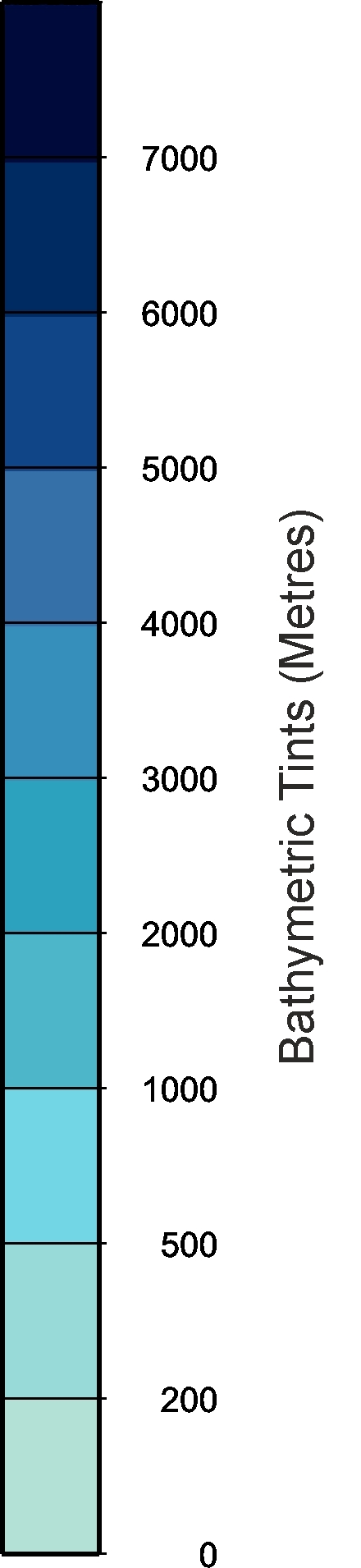
https://www.gebco.net/data_and_products ... rtical.jpg
^ GEBCO depth key/legend for bathymetric data.
That's getting closer to what I want -- the link below gives a 512x256 depth/elevation map image which would easily convert to Freeciv map, but no land cover data. At least the tile-to-pixel ratio is 1:1. Still no north pole though.
https://www.gebco.net/data_and_products ... sion=1.3.0
The "GreenMarble" color image has the north pole sea ice constructed from MODIS data -- it's accurate. You can copy the white shaded pixels to a new PNG for use as an Arctic ice overlay in your image (scaled up to size.) The base GreenMarble image is created by NASA. The north pole was added by the guy who controls the web site at the link.
Arctic overlay layer at 21600 pixel width --> https://www.sendspace.com/file/xkwy81
For the GEBCO bathy/elev 8 bit image, you could treat the one byte values as a range (0-255 meters), then using pixel x,y from your tst.png image file, determine if the pixel at x,y is water or land in your image. If land, convert 1 byte value from the depth/elevation image pixel at same x,y to elevation. If the pixel in your image is water, convert the 1 byte value to depth. There are only 2 ocean depths in Freeciv, so perhaps convert to only 2 values such as anything less than 100 meters depth is "ocean" and the rest are "deep ocean". Same with land for elevation as one of 3 or 4 levels. Freeciv depth/elevation is so coarse that this method would probably work out the same as actual values from a 2 byte per pixel image.
Or try this:
https://www.gebco.net/data_and_products ... sion=1.3.0
^ That is depth/elevation using current data from GEBCO. Unfortunately maximum width is 4096 (and equirectangular aspect ratio is 2:1) so you'd have to enlarge this to 21600x10800 to be at 1:1 pixel ratio with your image. I *ASSume* that pixel values represent # of meters as either depth or elevation.
https://www.gebco.net/data_and_products ... rtical.jpg
^ GEBCO depth key/legend for bathymetric data.
That's getting closer to what I want -- the link below gives a 512x256 depth/elevation map image which would easily convert to Freeciv map, but no land cover data. At least the tile-to-pixel ratio is 1:1. Still no north pole though.
https://www.gebco.net/data_and_products ... sion=1.3.0
